
Not everyone realises it, but you can freely access a significant amount of environmental, social, economic and geospatial data and information for the Waikato region from us.
Our scientists monitor key indicators like air and water quality and maintain regional state of the environment information for public use and to track how the environment is changing over time.
Our data is your data, so whether you’re curious, interested or concerned, feel free to have a look around and pass it onto others who might want to know about it too.
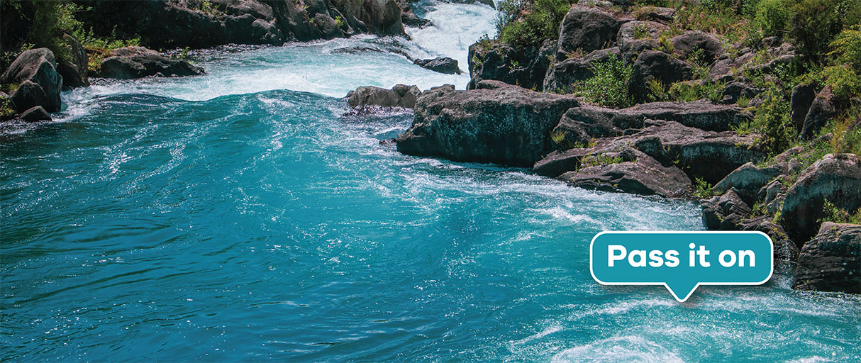
How clear is the water near you?
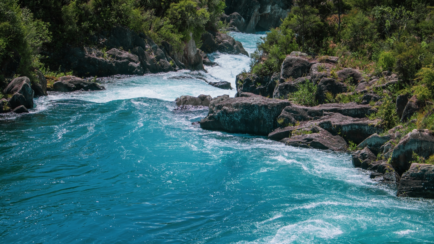
Water quality at Lake Taupō is excellent. You can see for over 10 metres underwater. By the time the water gets to Hamilton, it’s only 2-3 metres. We collect regional water quality data that we all need to know. Learn more about key indicators of river and stream health that we monitor and report and learn more about the state of the Waikato River.
You can find the latest water quality data for the Waikato region at LAWA.
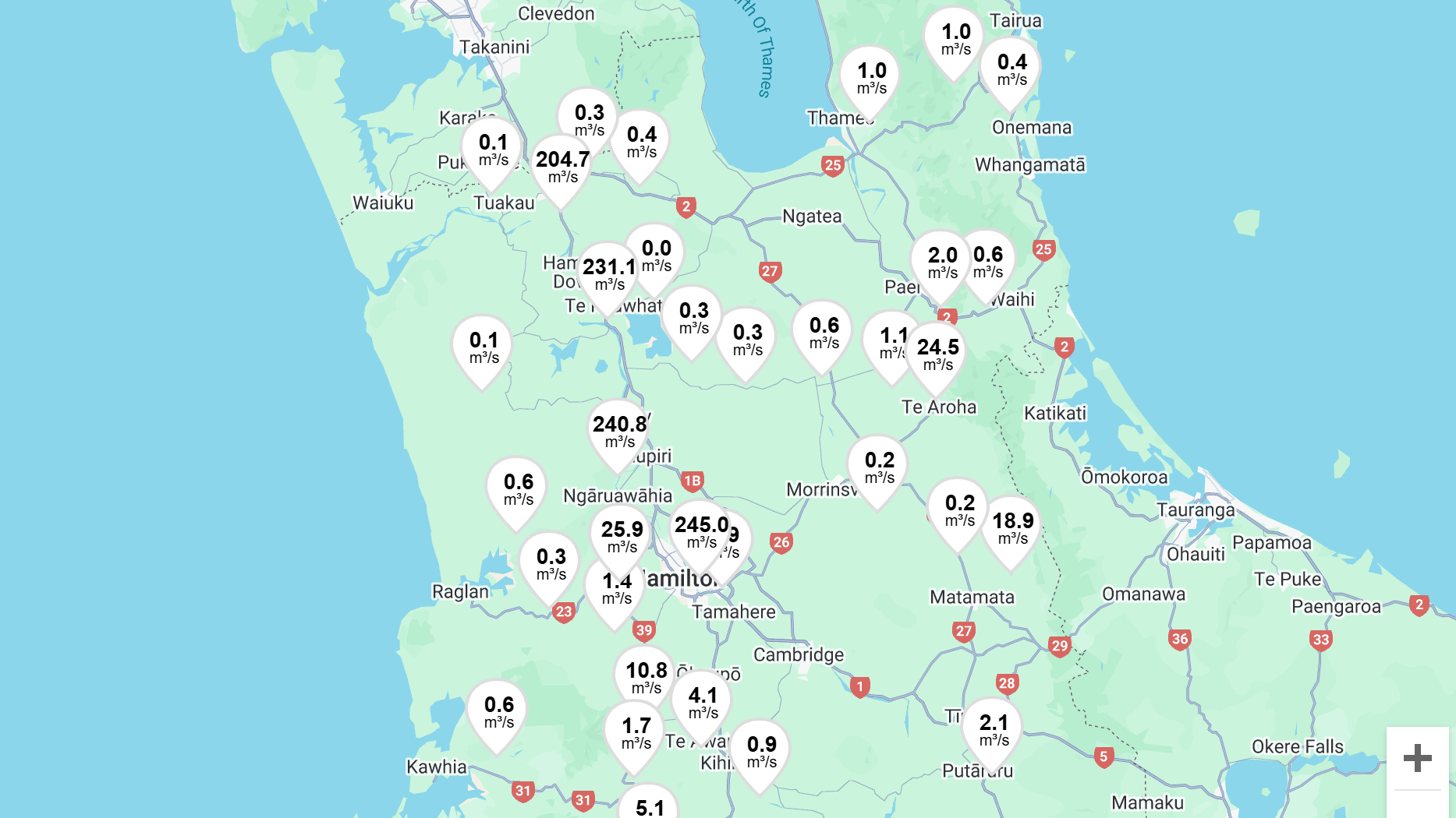
What’s the flow rate of your local river?
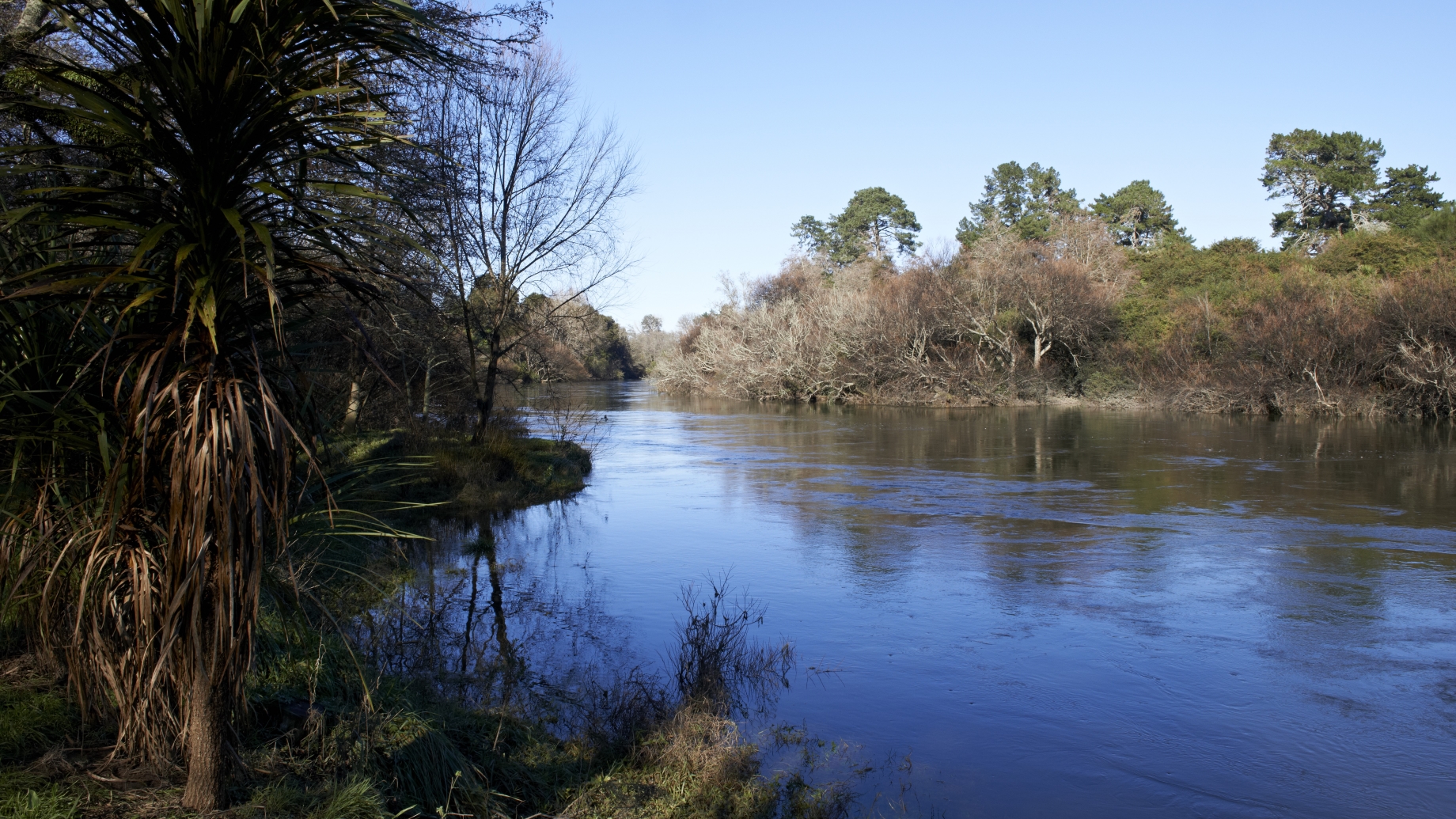
People draw fresh water from Waikato region rivers day and night. Low river flow tells us the resource is under pressure and restrictions may be needed. Our automated monitoring system alerts us when the flow drops too far. You can access up-to-date data on river flow and river levels in your area and see if low-flow restrictions apply.
Which native fish live near you?
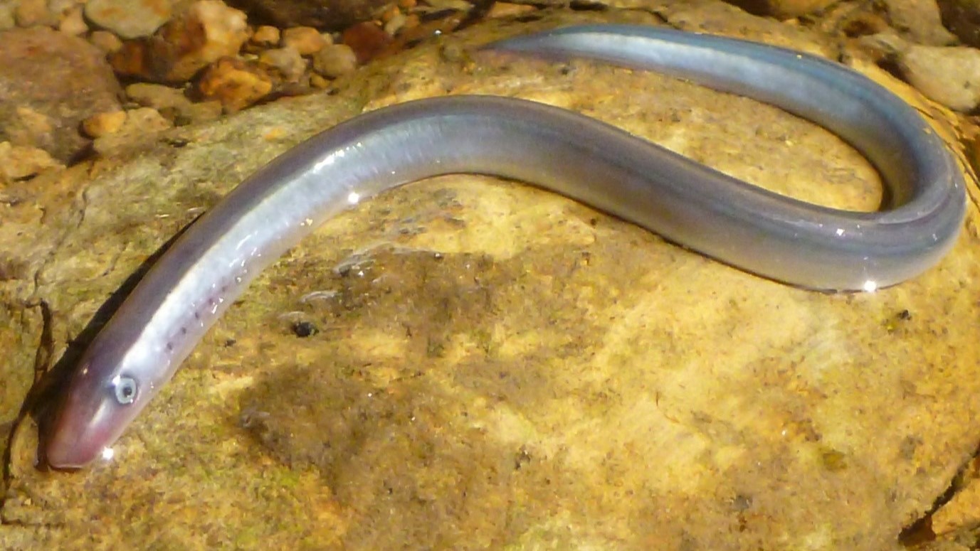
Fish and other living things leave traces of DNA in the waters they inhabit. We test Waikato region waterways with eDNA technology to reveal the life that lingers below. We know at least 22 native species live in the region’s waters, some of which may surprise you.
How healthy are the wetlands near you
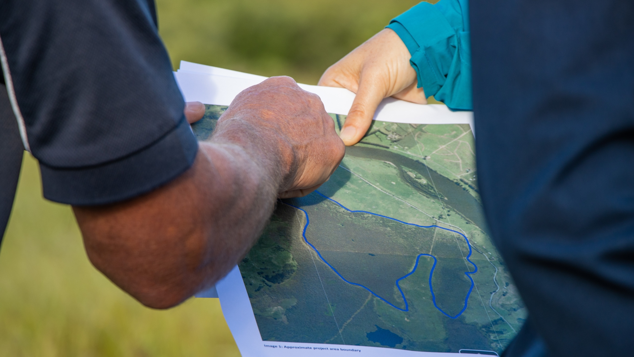
Waikato is home to 11 per cent of New Zealand wetlands, including two that are internationally significant. We have started monitoring their health to see how restoration efforts are tracking, and you can too.
Want to know more?
Check out the environmental data and interactive maps in our Environmental Data Hub. This site is fed by data feeds from monitoring sites around the region.

To ask for help or report a problem, contact us
Tell us how we can improve the information on this page. (optional)